

The Evolution of Navigation: From Ancient Seas to Modern Skies
The history of navigation is a fascinating journey through human ingenuity. It’s the story of how we learned to traverse vast distances using observation and calculation. At the heart of this story are two interconnected techniques: pilotage and dead reckoning. These methods guided explorers for centuries before the arrival of modern technologies like GPS.
Pilotage, simply put, is navigating by recognizing landmarks. Think of it as using a coastline, a mountain range, or even a particular tree to stay oriented and maintain your desired course.
Dead reckoning, conversely, involves calculating your current position based on a known starting point. This is done by estimating speed, direction, and travel time. Early sailors, for example, would use a knotted rope (called a log) to measure speed and a basic compass for direction.
From Phoenicia to Polynesia: Early Navigators
Pilotage and dead reckoning served as the bedrock of global maritime navigation for thousands of years. The Phoenicians, around 1200 BCE, are considered some of the earliest documented users of these techniques. They traded across the Mediterranean, estimating speed and direction using logs, ropes, and celestial cues.
By the 11th century, the magnetic compass, invented in China, revolutionized directional accuracy in dead reckoning. Ancient estimates could be off by tens of nautical miles over long voyages. The compass significantly reduced this, bringing error rates down to a few percent of the actual course.
Polynesian navigators, remarkably, traversed the vast Pacific with errors of up to 20 miles on a 600-mile journey. That’s roughly a 3% error rate. With the compass, European sailors in the 15th century usually achieved errors below 5 miles on similar distances. This improved reliability from approximately 95% to 98% accuracy in favorable conditions. Learn more about the history of dead reckoning here.
The Compass and Beyond: A Revolution in Accuracy
The magnetic compass significantly enhanced the accuracy of dead reckoning. However, challenges still persisted. Sailors contended with unpredictable currents, shifting winds, and the inherent difficulty of estimating speed over water.
The interplay of pilotage and dead reckoning was crucial in overcoming these obstacles. When landmarks were visible, pilotage offered a vital check on dead reckoning calculations. This allowed for necessary course corrections, ensuring voyages remained on track. Constant refinement and adjustment were the hallmarks of a truly skilled navigator.
These early techniques, refined over generations, paved the way for the Age of Exploration and the eventual emergence of even more sophisticated navigation tools.
The Science Behind Navigating Without Technology
Even before the advent of GPS and sophisticated electronic systems, mariners and aviators successfully navigated vast distances. At the heart of these traditional methods are basic mathematical principles, enabling surprisingly accurate navigation without modern tools. Let’s explore two key techniques: pilotage and dead reckoning.
Pilotage: Navigating by Sight
Pilotage relies on visual cues. Navigators use recognizable landmarks – mountains, rivers, distinctive buildings – to determine their location and chart their course. It’s similar to connecting the dots, where the “dots” are real-world features. The frequency of these visual checks increases with the proximity of landmarks, improving navigational accuracy. This method demands sharp observation skills and familiarity with the local terrain.
Dead Reckoning: Calculating Your Position
Dead reckoning, conversely, depends on calculation. Starting from a known position, navigators project their future location based on factors like speed, direction, and elapsed time. It’s akin to estimating distance traveled in a car by knowing its speed and travel time. However, dead reckoning incorporates more complex variables like wind drift and currents, making the calculations more intricate.
Understanding the historical context of navigation can be quite fascinating, including the modern evolution of drones. While drones rely heavily on technology, their development parallels the progression of navigation itself, from simple concepts to intricate systems.
To better illustrate the differences between these two techniques, let’s compare pilotage to dead reckoning. The table below provides a comprehensive comparison of the two primary traditional navigation methods, highlighting their distinct characteristics, applications, and limitations.
| Navigation Aspect | Pilotage | Dead Reckoning |
|---|---|---|
| Primary Reference | Visual landmarks | Calculated position |
| Starting Point | Recognizing familiar features | A known position |
| Environmental Influence | Less susceptible to drift but affected by visibility | Highly affected by wind, currents, and compass errors |
| Accuracy | High in familiar areas with clear visibility | Decreases over time and distance |
| Best Application | Coastal navigation, short distances | Open ocean, long distances when landmarks are unavailable |
| Limitations | Requires clear visibility and recognizable landmarks | Susceptible to cumulative errors |
As you can see, pilotage and dead reckoning offer distinctly different approaches to navigation. While pilotage excels in clear conditions with readily available landmarks, dead reckoning allows for navigation even when visual cues are limited.
Compensating for Environmental Factors
Both methods necessitate accounting for environmental variables. Wind drift, for instance, can significantly alter a ship or aircraft’s intended path. Similarly, ocean currents pose a considerable challenge for maritime navigation. Skilled navigators leverage experience and mathematical calculations to adjust for these factors. They also consider magnetic variation, the difference between magnetic north (shown by a compass) and true north, for accurate direction-finding.
Practical Calculations and Intuition
Dead reckoning often utilizes basic trigonometry and vector math to plan courses. Knowing the desired heading and speed allows navigators to calculate their anticipated position after a specific time. Modern tools like those discussed in How to master navigational aids can further enhance these calculations. Remarkably, experienced navigators develop an intuitive sense of position and movement, refining their accuracy over time. This intuition stems from a deep understanding of the environment and its subtle indicators. Learning these traditional methods fosters a deeper understanding of navigation principles that GPS can sometimes obscure.
Taking Flight: How Pilots Mastered The Empty Sky
The earliest days of aviation borrowed heavily from centuries of maritime navigation. Pilots adapted techniques like pilotage and dead reckoning, honed over generations at sea, to guide their aircraft through the uncharted expanse of the sky. This transition, however, presented its own set of unique challenges.
Adapting Maritime Techniques for the Air
Early aviators, like sailors before them, used pilotage – navigating by visible landmarks. But seeing these landmarks from the air required a new perspective. Rivers easily distinguished at sea level often blended into the landscape from above, and towns shrunk into tiny collections of buildings. Pilots had to learn to recognize how familiar terrain appeared from different altitudes, developing a sharp eye for detail.
Dead reckoning, the method of calculating position based on speed, direction, and time, also needed adjustments for air travel. While the core principles remained the same, a new factor came into play: wind. Unpredictable crosswinds could easily push an aircraft off course, requiring constant corrections and careful calculations to stay on track.
Overcoming the Challenges of Flight
Pilots devised methods to estimate wind speed and direction, often observing ground features or using basic drift indicators. They incorporated this information into their dead reckoning, adjusting their heading in real time. The development of new instruments like the airspeed indicator and altimeter provided more accurate measurements of speed and altitude, further improving dead reckoning accuracy.
Pilotage and dead reckoning became essential for longer flights in the early 1900s. By the 1930s, the U.S. Navy emphasized precision dead reckoning training, resulting in impressive accuracy. Naval navigators learned to maintain a course with an average error of only 0.5 degrees, a mere 0.5 miles off course for every 60 miles flown – an error rate of about 0.8%. On a 2,400-mile trans-Pacific flight, the total estimated dead reckoning error was just 20 miles, less than 1% of the total distance.
These methods remained vital, particularly for long-distance flights, until the mid-20th century. They proved that even with simple tools, skilled navigators could achieve remarkable precision before modern satellite navigation systems like GPS became available. These early aviators paved the way for the complex air traffic systems we rely on today.
For further reading on aviation decision-making, check out this article: How to master Aeronautical Decision Making.
The Navigator’s Toolkit: Instruments That Changed History
From ancient mariners charting courses across open seas to the pioneering aviators of the early 20th century, navigation has always depended on reliable tools. The methods of pilotage (navigating by visual landmarks) and dead reckoning (calculating position based on a previously known position) have relied on a core set of instruments that have evolved significantly over time. Let’s explore some of the key tools that transformed navigation and empowered explorers to venture into uncharted territories.
The Compass: Finding North and Beyond
The magnetic compass, a Chinese invention dating back to the 11th century, dramatically changed the course of navigation. Before its widespread adoption, sailors relied heavily on celestial navigation, using the sun, moon, and stars to determine their position and direction. However, this method proved unreliable in cloudy conditions. The magnetic compass, aligning itself with Earth’s magnetic field, offered a consistent way to determine direction regardless of weather conditions. This greatly improved the precision of dead reckoning, allowing for a more quantifiable approach to navigation.
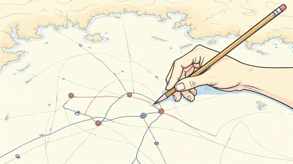
Charts and Maps: Visualizing the World
Charts and maps are indispensable visual aids for both pilotage and dead reckoning. Maps provide a graphical representation of terrain, landmarks, and other navigational features, enabling pilots and sailors to determine their location and plan routes. Charts, designed specifically for nautical and aeronautical navigation, contain crucial information for dead reckoning calculations, including distances, magnetic variation, and prominent landmarks.
Timekeeping Devices: The Element of Time
Accurate timekeeping plays a vital role in dead reckoning. Knowing the elapsed time since departure is essential for calculating distance traveled based on speed. Early navigators used basic tools like sandglasses and hourglasses, but the invention of mechanical clocks, and later, more precise chronometers, greatly enhanced accuracy in timekeeping. This advancement enabled much more precise estimates of position, which became increasingly critical for longer voyages.
Measuring Speed: From Chip Logs to Knotted Ropes
The chip log and its successor, the knotted rope, were ingenious tools used by sailors to measure speed. The chip log consisted of a wooden board attached to a line with knots tied at regular intervals. The chip was thrown overboard, and the rate at which the knots passed through the sailor’s hands over a set time period gave an estimate of the ship’s speed. This information directly factored into dead reckoning estimations.

The Sextant: Celestial Navigation for Precision
Invented in the 18th century, the sextant provided a way to precisely measure the angle between celestial bodies like the sun and stars and the horizon. This enabled more accurate determination of latitude and longitude, vital for navigation in the open ocean. While not directly a tool of dead reckoning, sextant fixes provided a reliable way to correct for accumulated errors in dead reckoning calculations, ensuring greater accuracy over long distances.
The Flight Computer: Calculations Take Flight
With the advent of aviation, pilots adopted and adapted many of these maritime navigation tools. The development of the flight computer, an analog calculator, significantly advanced dead reckoning in the air. This tool helped pilots quickly compute crucial information such as fuel consumption, ground speed, and time en route, incorporating factors like wind speed and direction. These calculations, combined with pilotage using aeronautical charts, enabled early pilots to navigate vast distances.
Essential Navigation Tools That Transformed Exploration
Let’s take a look at some of the primary instruments used in pilotage and dead reckoning, explaining their purpose and proper usage.
| Navigation Tool | Primary Function | Usage Technique | Accuracy Considerations |
|---|---|---|---|
| Magnetic Compass | Indicate magnetic north | Align compass needle, read bearing relative to north | Magnetic variation, local anomalies can affect accuracy |
| Charts and Maps | Visual representation of geographic area | Identify landmarks, plot routes, measure distances | Chart accuracy, scale, and projection can influence precision |
| Chronometer | Precise timekeeping | Measure elapsed time for dead reckoning calculations | Accuracy of timekeeping directly affects distance calculations |
| Chip Log/Knotted Rope | Measure ship’s speed | Count knots passed over a specific time interval | Affected by currents and ship’s motion |
| Sextant | Measure angle between celestial bodies and horizon | Sight celestial body, read angle on scale | Requires clear skies, precise measurements for accurate position |
| Flight Computer | Calculate flight parameters | Input data (wind speed, direction, etc.), read output (ground speed, time en route) | Accuracy depends on input data and pilot technique |
These are some of the vital instruments used throughout history for navigation. Each tool played a crucial role in making exploration safer and more accurate.
These instruments, from the simple compass to the complex flight computer, represent significant advancements in navigation. Each innovation built upon previous techniques, improving the accuracy and reliability of pilotage and dead reckoning. This knowledge isn’t just for history books; it continues to be relevant for modern adventurers. It provides a backup system in situations where technology might fail and offers a deeper understanding of the art of navigation. For example, you can learn more about flight computers here: How to master a flight computer.
When GPS Fails: The Enduring Relevance of Traditional Skills
In our technologically advanced world, it’s tempting to think GPS has made traditional navigation skills obsolete. However, pilotage and dead reckoning remain essential, especially in aviation. These methods offer a vital backup when technology falters, ensuring safety in critical situations.
The Importance of Backup Navigation
Electronic aids and GPS revolutionized navigation. In 1980, before GPS was fully operational, roughly 90% of civil aircraft relied on pilotage, dead reckoning, and radio navigation. By 2000, GPS had decreased this to about 15%. But these traditional methods remain relevant. As recently as 2022, approximately 80% of pilot training programs globally still emphasized pilotage and dead reckoning, with these skills needed in about 10% of in-flight emergencies. Find more statistics here. This underscores their importance as a safety net when modern systems fail.
Over-reliance on GPS can also breed complacency. Pilots neglecting traditional skills may find it difficult to reorient themselves if GPS becomes unavailable. Pilotage and dead reckoning foster a deeper understanding of spatial awareness and decision-making, crucial for any pilot.
Real-World Scenarios: When Tradition Saves the Day
Many incidents highlight the importance of pilotage and dead reckoning. Consider a pilot encountering complete GPS failure over mountainous terrain. Without electronic guidance, pilotage, using landmarks for navigation, becomes critical. Dead reckoning, estimating position based on time, speed, and direction, helps pilots reach safety when other systems are down.
Integrating Traditional and Modern Methods
Best practices now combine both approaches. Pilots utilize GPS for efficiency and precision while maintaining traditional skills. This builds a robust navigation strategy. For example, during pre-flight planning, pilots might identify landmarks. This prepares them to use pilotage if GPS fails, allowing a smooth transition to backup navigation.
You might find this interesting: How to master cross-country flight planning.
Beyond Aviation: A Wider Application
These skills benefit more than just commercial and military pilots. Private pilots, hikers, sailors, and anyone venturing beyond reliable cellular coverage gain from learning pilotage and dead reckoning. These techniques foster self-reliance and confidence no electronic device can replicate, empowering individuals to navigate safely even when technology fails.
Mastering The Lost Art: Your Path to Navigation Confidence
Building Navigational Intuition
Becoming proficient in pilotage and dead reckoning is a journey. Begin in familiar surroundings. Practice identifying landmarks and estimating distances in a local park or on a well-known hiking trail.
As your comfort level increases, gradually introduce more challenging environments. Try navigating a longer route using a map and compass, using dead reckoning to track your position between landmarks.
Structured Exercises for Skill Development
Professional navigators often highlight the importance of structured practice. One helpful exercise involves navigating a pre-planned route using only pilotage, marking your location on a map at regular intervals.
Later, compare your actual path with your planned route, and analyze any differences. This practice sharpens your landmark identification and distance estimation. Complement this with dead reckoning practice in a controlled area like a large open field. Walk or cycle a specific course, estimating your speed and direction, and then compare your final position to your initial calculations.
You might be interested in learning more about sectional charts. Sectional charts are valuable for pilotage, offering details on landmarks, terrain, and airspace.
Advanced Techniques and Challenging Conditions
As your skills grow, consider incorporating more demanding scenarios. Practice pilotage in low-visibility conditions, like fog or light rain, concentrating on identifying prominent, visible features. Similarly, refine your dead reckoning by factoring in elements like wind and current, common influences in real-world navigation.
Resources and Communities for Continued Learning
A multitude of resources exist for those seeking to master navigation skills. Look for specialized courses led by seasoned navigators. These courses often combine classroom learning with practical field exercises, offering a comprehensive learning approach.
Consider joining online or local navigator communities to share knowledge and learn from others’ experiences. Connecting with fellow enthusiasts can be a powerful source of motivation and continued learning.
Applying Navigation Skills in Everyday Life
The value of pilotage and dead reckoning extends beyond activities like sailing or hiking. These abilities strengthen spatial awareness, observation skills, and decision-making in various situations.
Understanding how to estimate distances and identify landmarks can be valuable when exploring unfamiliar cities or navigating new roads. Furthermore, developing a strong sense of direction improves your confidence and independence in everyday life. Mastering these skills equips you to navigate the world with assurance and a deeper connection to your environment.
Recent Posts
FAA MOSAIC Final Rule: What Pilots, Manufacturers, and the Aviation Community Need to Know
Learn how the FAA’s MOSAIC final rule revolutionizes Light-Sport Aircraft certification, expands Sport Pilot privileges, and reshapes general aviation. See what’s changing, when it takes effect,...
Student Pilot Insurance: Essential Coverage for Aspiring Flyers
Discover how student pilot insurance can protect your flying dreams. Get expert tips and coverage options to ensure your safety and peace of mind.