

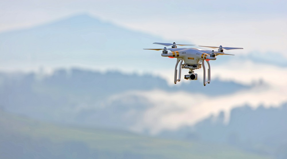
Drones, also known as unmanned aircraft systems (UAS), are changing the face of aviation. They are being used for everything from aerial photography and package delivery to infrastructure inspection and emergency response. But as drone numbers continue to rise, they are beginning to share airspace with traditional aircraft. For student and private pilots, this brings both opportunities and challenges.
Understanding how drones are integrated into the National Airspace System (NAS) is now a key part of being a safe and responsible pilot. This article will explain how drones operate, where they are allowed to fly, how regulations are evolving, and what you should know to avoid conflicts in the sky.
The Growth of Drones in Aviation
In just a few years, drone use has expanded at an astonishing pace. The Federal Aviation Administration (FAA) estimates that over 800,000 drones are registered in the United States. Many are flown recreationally, but a growing number are being operated commercially under FAA Part 107 rules.
These drones range from small quadcopters that weigh less than a pound to larger, professional-grade systems with long-range capabilities. They are used in nearly every industry, including:
- Real estate and filmmaking
- Agriculture and forestry
- Construction and utility inspection
- Search and rescue
- Law enforcement
- Environmental monitoring
Some companies are also developing drone delivery networks and air taxis, which may one day operate alongside traditional aircraft in low-altitude corridors.
Airspace Basics for Drones
Like manned aircraft, drones must operate within the rules of the National Airspace System. But their access is more restricted, and how they’re integrated into the airspace depends on the type of drone and the purpose of the flight.
Here is a general breakdown of where drones are allowed to fly:
Recreational Drones
- Must fly below 400 feet AGL
- Must stay away from airports and air traffic
- Must maintain visual line of sight
- Must fly within Class G airspace unless they receive authorization through LAANC (Low Altitude Authorization and Notification Capability)
Commercial Drones (Part 107)
- Must follow many of the same restrictions as recreational drones
- Can request authorization to operate in controlled airspace
- Must have a Remote Pilot Certificate
- Can fly in Class B, C, D, and E airspace with FAA approval
What Is LAANC?
The Low Altitude Authorization and Notification Capability (LAANC) is a system that allows drone pilots to request access to controlled airspace (typically around towered airports) in near real-time. This is available for both recreational and commercial drone operators.
LAANC integrates with airspace maps and allows requests to be reviewed and approved digitally. For example, if a drone pilot wants to fly near a Class D airport, they can use LAANC to request permission and receive a ceiling limit for that operation.
For manned aircraft pilots, this means drones may legally be flying in places that used to be considered “off-limits” for them. Awareness is essential.
Challenges of Integrating Drones into Shared Airspace
1. Low-Altitude Crowding
Drones primarily operate in low-altitude airspace (below 400 feet AGL), which is also used by helicopters, agricultural aircraft, pipeline patrols, and VFR pilots entering or exiting patterns. As drone traffic increases, the likelihood of an encounter grows.
2. Visual Limitations
Many drones are small and hard to see, especially at a distance. Even with good visual scanning, spotting a hovering or fast-moving drone is difficult, particularly in hazy conditions or near the horizon.
3. Lack of Standard Communication
Unlike manned aircraft, drones do not typically broadcast on ADS-B or monitor radio frequencies. This makes it harder for pilots and controllers to track or communicate with them.
4. Automation and Autonomy
Some advanced drones operate autonomously, following GPS coordinates or reacting to changes in weather or obstacles. While this improves mission efficiency, it can also lead to unpredictable movements that increase risk for nearby aircraft.
UTM: The Future of Drone Airspace Management
To safely integrate drones, the FAA and NASA are developing a system called UTM, or Unmanned Aircraft System Traffic Management. UTM will eventually function like air traffic control for drones, managing large numbers of aircraft in low-altitude airspace.
Key features of UTM include:
- Real-time tracking of drone positions
- Automated deconfliction (separating traffic)
- Geofencing and route enforcement
- Emergency alerting and rerouting
- Integration with traditional ATC for situational awareness
For pilots, this means that many drones in the future may be automatically monitored and coordinated with crewed flights, reducing the risk of conflict.
What Pilots Need to Know About Drone Operations
Even as UTM develops, private pilots must take responsibility for staying safe around drone operations. Here’s what you need to keep in mind:
1. Know Where Drones Fly
- Use apps like B4UFLY, Aloft, or your EFB (ForeFlight, Garmin Pilot) to check for UAS activity.
- Review NOTAMs and TFRs, as some large drone operations or testing events may be published in advance.
- Be cautious around agricultural fields, sporting events, and large construction zones.
2. Practice Good Situational Awareness
- Scan below and ahead for small, hovering drones.
- When entering the pattern at non-towered airports, keep an extra eye out, especially below 400 feet AGL.
- Use proper pattern entry procedures to avoid surprises from drone operators who may be flying near the airport.
3. Understand Reporting Procedures
If you experience a close call with a drone:
- Report it to ATC if you are in controlled airspace.
- Use the FAA Drone Incident Reporting Form on their website.
- Provide details including location, altitude, drone appearance, and direction of movement.
4. Know the Rules for Flying Your Own Drone
Many private pilots also fly drones recreationally or professionally. If you do:
- Understand the difference between Part 107 and recreational rules
- Always check for airspace restrictions
- Register your drone and label it with your FAA registration number
- Learn how to use LAANC for airspace access
Flying both manned and unmanned aircraft gives you a helpful perspective, but it also means you need to follow both sets of rules.
Drone Detection and ADS-B
Some newer drone models and UTM systems may include Remote ID, which acts like a digital license plate for drones. It transmits:
- Location of the drone
- Location of the control station
- Altitude and speed
- Time stamp
Remote ID will help law enforcement and aviation authorities identify drones in real time. Over time, this may integrate into ADS-B In displays and EFBs, improving traffic awareness for pilots.
However, most drones today are not equipped with Remote ID or ADS-B, which means VFR pilots must rely on visual detection and avoidance.
Real-World Example: Entering Class D with Drone Activity Nearby
Let’s say you are flying into a Class D airport known to have regular drone activity in the nearby industrial park.
- Check your EFB or B4UFLY to see if any drone operations are active.
- Monitor CTAF or ATIS for any warnings.
- Call the tower early with your position and intentions.
- If the controller advises “unmanned activity southeast of the field,” steer clear and ask for clarification on altitude and area.
- Maintain visual vigilance below 500 feet and announce your position clearly on final.
Final Thoughts
Drones are here to stay, and they are becoming a normal part of our shared skies. As a student or private pilot, your awareness of drone activity and the evolving airspace structure is critical to staying safe.
The more you understand about how drones operate, how they are integrated, and what tools are available to detect them, the better prepared you will be. Fly with your eyes open, stay informed, and embrace the shared responsibility of safe flight in today’s evolving airspace.
Sources:
– FAA: *Integrating Drones into the NAS*
– FAA: *Part 107 Rules for Commercial Drone Use*
– NASA: *UTM (Unmanned Aircraft System Traffic Management)*
– FAA: *Remote Identification of Unmanned Aircraft*
– B4UFLY App by the FAA and Aloft Technologies
Recent Posts
FAA MOSAIC Final Rule: What Pilots, Manufacturers, and the Aviation Community Need to Know
Learn how the FAA’s MOSAIC final rule revolutionizes Light-Sport Aircraft certification, expands Sport Pilot privileges, and reshapes general aviation. See what’s changing, when it takes effect,...
Student Pilot Insurance: Essential Coverage for Aspiring Flyers
Discover how student pilot insurance can protect your flying dreams. Get expert tips and coverage options to ensure your safety and peace of mind.